22. Settlement Satellites
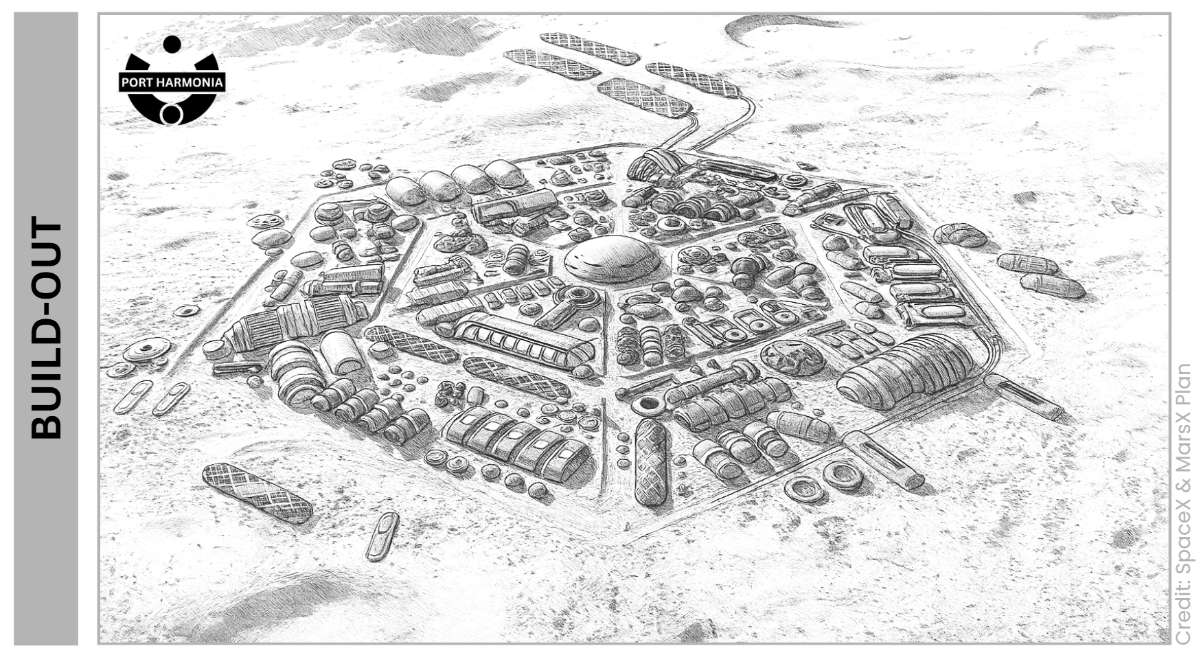
We had a map with circles on it and a promise we couldn’t possibly keep. That was the point. The “regional radii” plan — drawn in confident ink on a boardroom wall — imagined Port Harmonia growing like a ripple tank: near ring to mid ring to far ring, corridors becoming roads becoming rail, padports bracketing the compass, satellites hardening into towns. As any general could have told us, the plan would not survive first contact with dust, budget, and weather; but the act of planning taught us where the ground would try to trick us. Freight cares little for speeches. It listens only to grades, wind, and maintenance.
♦
The original ‘MarsX Direct’ playbook was simple enough to memorize. Near ring (0–50 km): finish the capital, belt the heavy plant, stand up Padport A downwind at ~45 km, and run two flagged trunks — one to ice, one to aggregates. Mid ring (50–150 km): turn flag lines into prepared corridors, open the first industrial satellites (water and materials), and start two ring-road arcs. Far ring (150–400 km): build a second, opposed padport, seed the first 1k town where latency demanded it, and reserve a rail belt alignment even if the rails themselves were a rumor. Everything else was a trigger, not a vow: rail only when a corridor carried ≥200 t/sol for ≥100–150 km on ≤1% grades for three continuous years; water pipelines only once a flow had proven ≥80–100 t/day for ≥5–10 years; interties for mutual aid, never as oxygen umbilicals. Publish corridor law, cache spacing, and container geometry on day one so rivals would either plug into our standards or bleed fighting them. That was the opening theory on the board.
Reality kept most of it and shuffled the order.
♦
The first decade stayed inside the near ring because mass hated exaggeration. We put Padport A on the Leeward Flats — bedrock patches, clean approaches — and we got lucky with winds that behaved like the mesoscale models said they would. Boreal Ice Works went in at ~30 km NW, close enough to haul water with dull efficiency while we learned which pumps sulked at night. Ridgegate Materials opened ESE at ~40 km on the lee of a low bench, turning rock into aggregate and binders into culverts and gallery walls that stopped existing as line items and started existing as habits. Those two satellites did more for Port Harmonia than any uplinked ribbon-cutting: they cut import tonnage and taught our convoy doctrine its manners.
Then the weather flexed. A long dust season arrived with the personality of a cat — aloof, then suddenly everywhere. Our eastbound flagged track bogged twice in mantled fines. We learned to harden the pull-outs early, to fence the drift-prone cuts, to stage tow modules every 25–50 km and call that “policy” rather than “luck.” Prepared corridors grew not because a plan said so but because the maintenance ledger yelled so. When we laid the first water line from Boreal, it wasn’t because pipes were glamorous; it was because the flow had sat above 80 t/day for long enough that the numbers finally stopped arguing.
Padport B came earlier than the boardroom had predicted. Seasonal plume recirculation at A clipped our cadence two windows in a row; the fix was not pleading with wind but giving wind a second target. We planted the opposed padport ~100 km away, in the Outwash Flats — far enough to be seasonally independent, close enough to be threaded by a trunk we could afford to maintain. With two air doors open, the city’s breathing became predictable, which is what you really buy with concrete.
The first town — Amazonis Ville — did not arrive as a conquest pin but as an apology to medics and mechanics. Latency to the South-West worksites ate margins and patience. At ~260 km out, the Junction took the obvious role: L3-lite hospital, fabrication that didn’t require a round trip to the capital, and a yard that looked suspiciously like a future rail terminal. When the SW trunk crossed the road-train trigger a generation later, we pretended to be surprised for decorum’s sake, then laid steel in a corridor we had quietly built to rail load standards from day one.
♦
Here’s the cheat sheet we lived by — names, bearings, distances, and the only column that really matters: why.
Node | Type | Bearing / distance | Lat-Lon coords. | Why it existed |
Port Harmonia | City Hub | - | 35N 215E | On Amazonis / Arcadia Planitia flats, to west of Lycus Thrust (Acheron Fossae) |
Padport A | Padport | NE (Downwind) ~45+ km | 36N 216E | Early heavy EDL, minimal plume risk to people, short hauls. |
Padport B | Padport | SW ~100 km | 34N 214E | Seasonal redundancy; export spine anchor; denial move. |
Boreal | Industrial satellite | N ~100 km | 37N 214N | High-confidence water hub; pipeline once flow proved ≥80 t/day. Also useful geology and mine. |
Ridgeway | Industrial satellite | ESE ~70 km | 34N 217E | Aggregate + sulfur/geopolymer binders; civil mass saver. |
Acheron (Clayfields Mine) | Industrial satellite | ENE ~360 km | 35N 222E | Ceramics & membranes; life-support and fab up-chain, in Acheron Fossae |
Solaron (Oxide Solar Flats) | Industrial satellite | SW ~120 km | 33N 212E | Solar farms extension; Fe/Mg upgrading; local metallurgy; second resource azimuth. |
Amazonis Ville | Town (~1k) | SW ~260 km | 31N 210E | Med/fab hub; first travel node; latency reducer for SW axis. |
Lycus Ville | Town (~1k) | SE ~330 km | 31N 220E | Heavy workshops; sleeper/beam casting; WSW rail candidate. |
Arcadia | Science & | W ~420 km | 35N 209E | Advanced science on open Planitia. Doubles as a link way station for western resource trade arc. |
New Hawaii | Science & | W ~1,200 km | 39N 193E | Advanced science on Erbus Montes ridge island chain |
Erbus Ville | Town (~1k) | W ~1,650 km | 36N 187E | Acts as the western trade hub; completes the strategic coverage of Erbus Montes. |
New Milan | Science & | N ~1,450 km | 54N 213E | Advanced science in Polar region; strategic coverage of Vastita’s Borealis (Scandia Colles) |
The trunks that tied them together were named with the merciless cheer of engineers who know they’ll be saying the names for a century.
Spoke Borealis (Vastitas) ran North (NNW initially) to Boreal, then onto New Milan (Milankovic Crater). The two support stations on the way north from Port Harmonia to New Milan are Aldrin Station (44N 213E), Zurbrin Station (49N 213E).
Spoke Erbus (Montes) ran West to Arcadia, then on to Erbus Ville and New Hawaii. The three support stations on the way west from Port Harnomia to Erbus Ville and New Hawaii, are McGregor Station (39N 196E), BocaChica Station (35E 201E), Hawthorne Station (35N 194E).
Spoke Marte (Vallis) ran South West between the Agri and Solar zones to Solaron then Amazonis Ville.
Spoke Olympus (Mons) ran South East between the Solar and Industrial zones to the Ridgeway and then on out to Acheron and Lycus Ville.
Starport Spoke ran as a stub to the North East, and the wider Padport A zone.
♦
What changed from the original MarsX Direct pristine plan? Less than cynics guess, more than romantics like to admit. We slid phases by Hoff cycles and decades. We went heavier on dust fencing, earlier on pull-outs, later on pipelines (water only, and only when the math shut up). We insisted that every satellite and town be able to sulk alone—reactors N+1, O₂/H₂O local, containers in and out—so that interties remained favors, not lifelines. We upgraded Spoke-Olympus before Spoke-Erbus, because ceramics, ice, and people moved with a cadence steel couldn’t ignore. We delayed the SE spur until the three-town belt made it worth the fuel. But the skeleton the board drew—the dual padports, the azimuthal split of critical resources, the ring first and spurs later—held.
And the “why” that tied it back to siting never stopped being obvious to anyone who pushed a cart: Port Harmonia had been put where lowland air made EDL cheap, where two honest exits could be cut without teaching trucks to climb, and where the neighboring districts offered headroom enough for a ring, a second padport, and three future towns without elbowing Planetary Protection. The regional radii were not an imposition on the site; they were what the site had been chosen to invite.
♦
The ring hardened where the ledger said please. Spoke-Olympus crossed the road-rail trigger first — three years running above 200 tonnes per sol over more than a hundred and fifty kilometers, with grades we’d bullied down to a percent on most of it. The first freight road-train took twelve hours off the Lycus Ville to Capital loop and halved our energy per tonne-kilometer. It also made the road crews suddenly religious about drainage. You learn quickly that rails are prima donnas; they reward discipline and punish romance.
Spoke-Ridge extension spur to Acheron followed two decades later, not because the plan said “second,” but because the workshops were casting beams faster than convoys could drink them. The SE Outflow arc held its nerve until Amazonis and Erbus matured; then we stitched them with a straightness that offended poets and delighted schedulers. By the time we closed the Erbus Loop into a proper link, road-trains could pass each other on long tangents while a sand devil crossed the road lanes and decided we were none of its business. That was the feeling we were buying: storms as scenery rather than policy.
♦
Clayfields cut our import diet the way a good kitchen cuts salt. Filters, membranes, kilnware — small, precious things that otherwise arrive wrapped in expense — started rolling out of Archeron at a pace that turned a hundred requisitions a month into ten. Oxide Flats did the same trick to metals: not miracles, but honest upgrading — magnetics and roasting that spat out Fe/Mg stock you could weld into brackets, frames, and the occasional unlovely but immortal truss. Together they gave our bill of mass a waistline. Interiors held at ~30 kg/m² without apology; spares drawers stopped looking like Earth catalogues and started looking like a Port Harmonia parts bin.
There’s a line in my notes from that period: “Local ceramics make life support boring.” It’s high praise. Boring life support means the medics talk about stubborn rashes instead of oxygen; it means maintenance logs argue about bearings rather than membranes; it means the city stops pretending imported cleverness will save it and gets on with the work of being alive.
♦
I was asked how big the region really got at that time — how many Zands and Sectors the mature Arcadia-Amazonis sphere touched when the belt closed and Outwash sang. The honest answer is that we stayed inside a Quads area but roamed freely within it. But as Port Harmonia sat at the boundary of Delta and Kappa Quads themselves, the sphere of influence covered both.
A 400–500 km radius puts you across ~4–6 Zands at ~40°N, depending on where you place the capital in its home cell. By area, a 500 km radius circle is ~785,000 km², which is a polite way of saying “about two hundred Sectors and on the order of twenty Provinces,” case-by-case depending on how your ring clips grid lines. For those of you that prefer this in Earth’s country terms, that’s the same size as Turkey, or just a touch bigger than Texas.
No one measured it for romance. We counted it because fiber had to be trenched, caches had to be audited, and governors like to know how many mayors they will meet.
If you prefer a scoreboard, this one aged well:
Radius | Area (πr²) | ≈ Sectors covered | ≈ Provinces covered | Zands touched | Earth | USA |
300 km | ~283,000 km² | ~80 | ~8 | 2–3 | ~UK | ~Nevada |
400 km | ~503,000 km² | ~140 | ~14 | 3–5 | ~Spain | ~California |
500 km | ~785,000 km² | ~220 | ~22 | 4–6 | ~Turkey | ~Texas |
These are not world-conquering numbers; they are maintenance numbers. They tell you how many culverts you will argue about, how many stations need a new defib, how many caches a bureaucrat will forget to refill and a passing convoy will quietly restock because cultures are built of small embarrassments handled well.
Remember Mars has the same land area as Earth, and nobody would say that if their sphere of influence just covered Texas they had conquered the world. Well maybe Texans would, but that’s local politics for you.
♦
And so the sketch became a network: road-rails when the numbers insisted, pipelines only for water and only after tedium, towns when latency embarrassed us, Outwash humming, standards quietly tyrannical. When people recite the prophecy about Port Harmonia now, it sounds grand: “the city that made the rest of the planet cheaper.” What it felt like then was less lyrical: a day where the trains were on time, the mass driver thumped exactly twice before breakfast, the clinics at Arcadia Junction signed off two surgeries without paging the capital, and a Boreal pipeline gauge was boring.
All of this loops back to siting. The quad and zand choices pre-baked the option to do this without contortion. Two honest exits, lowland air you can afford to fall through, resource baskets spread by azimuth, benches and ridges you can lean into, and neighbors that can grow into towns without tripping over masks—the regional radii were not assembled against the grain; they followed it.
We didn’t color the map. We tuned it. And once the belt was singing, everyone else tuned to it too.
But let’s now go further into the details and look at the Tile and Click selection of Port Harmonia’s site.